HomeMapping drone gps
Price (₦)
-
Discount Percentage
Brand
Mapping drone gps
(200 products found)
Related results:
Discover the precision and efficiency of mapping drone GPS technology, designed to revolutionize aerial surveying and data collection. Our advanced drones utilize state-of-the-art GPS systems to deliver accurate geospatial mapping solutions for various industries, including agriculture, construction, and environmental monitoring. Enhance your project outcomes with high-resolution imagery and detailed topographical data, enabling informed decision-making. Explore our range of mapping drones and elevate your operational capabilities to new heights with cutting-edge technology.


Out of Stock
S197 GPS Drone1 4K Professional HD 4K Dual Camera Lens With 2 Big Batteries & Screen Remote 5G WIFI 500m -1km 360°Obstacle Avoidance Brushless Foldable Quadcopter
₦ 302,999
₦ 319,999
-5%


Professional Dronen Dual Lens Camera 4K HD 5G WIFI GPS FPV Optical RC 4-Axis Aerial Photography Obstacle Avoidance Screen Remote Control 1.5km & 2 Batteries
₦ 820,753
₦ 850,000
-3%

E99 camera 4KHD Smart Video
4 (3)
₦ 65,000


S197 GPS Drone1 4K Professional HD 4K Dual Camera Lens With 2 Big Batteries & Screen Remote 5G WIFI 500m -1km 360°Obstacle Avoidance Brushless Foldable Quadcopte
₦ 303,999
₦ 319,999
-5%


S136 GPS Drone1 4K HD Dual Camera Professional 5G Aerial Photography Obstacle Avoidance WiFi FPV Quadcopter Brushless Automatic Return With 2 Batteries
₦ 390,872
₦ 500,000
-22%


Professional GPS Drone F7 4K HD Camera 5G WIFI 3-Axis Gimbal 3KM Optical Flow System With 2 Battery
₦ 565,249
₦ 594,999
-5%


GPS Drone1 4K HD Dual Camera Professional 5G Aerial Photography Obstacle Avoidance WiFi FPV Quadcopter Brushless Automatic Return With 2 Batteries
3.3 (10)
₦ 180,499
₦ 199,999
-10%


Out of Stock
GPS Drone1 4K HD Dual Camera Professional 5G Aerial Photography Obstacle Avoidance WiFi FPV Quadcopter Brushless Automatic Return With 2 Batteries
₦ 180,000
₦ 199,999
-10%


K19 Max GPS Drone Dual Camera 5G FPV Transmission Brushless Remote Control Aerial Photography Airdrop 4.5 inch Screen Display
₦ 320,650
₦ 400,000
-20%


New 4K Professional Drone Dual Lens Camera 4K HD 5G WIFI GPS FPV Optical RC 4-Axis Aerial Photography Obstacle Avoidance With Screen Remote Control 1km With 2 Batteries(2500mAH)
₦ 237,500
₦ 250,000
-5%


Out of Stock
K911 MAX GPS Obstacle Avoidance Dual 4K HD Camera Drone
₦ 279,999
₦ 299,999
-7%


Professional Dronen Dual Lens Camera 4K HD 5G WIFI GPS FPV Optical RC 4-Axis Aerial Photography Obstacle Avoidance Screen Remote Control 1.5km & 2 Batteries
₦ 303,999
₦ 319,999
-5%

Ar Drone E99 camera Smart Video
₦ 75,000


For Professionals 2025 New S197 GPS Droné With Screen Controlled Memory Card 8K HD Camera Obstacle Avoidance Aerial Brushless 5G Droné 6KM
₦ 1,658,000
₦ 2,000,000
-17%


YLRC 2000m GPS Professional Drone 5G WiFi 4K HD Camera 3-Axis Gimbal Anti-Shake Obstacle Avoidance With 2 Batteries
1 (2)
₦ 189,999
₦ 199,999
-5%

Professional Dronen Dual Lens Camera 4K HD 5G WIFI GPS FPV Optical RC 4-Axis Aerial Photography Obstacle Avoidance Screen Remote Control 1.5km & 2 Batteries
₦ 779,950
₦ 821,000
-5%

Anti-interference GPS WiFi 4KHD Smart Video Camera Drone
3.8 (4)
₦ 65,000


S136 GPS Drone 4K HD Dual Camera Professional 5G Aerial Photography Obstacle Avoidance WiFi FPV Quadcopter Brushless Automatic Return With 2 Batteries
₦ 168,500
Low Stock


For Professionals 2025 New S197 GPS Drone With Screen Controlled Memory Card 8K HD Camera Obstacle Avoidance Aerial Brushless 5G Drone 6KM
₦ 1,980,368
₦ 2,000,000
-1%
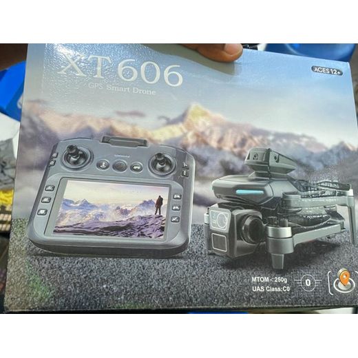
Out of Stock
Flying camera XT606 GPS Smart Drone – Advanced Aerial Photography & Smart Flight Drone
₦ 235,000
₦ 260,000
-10%
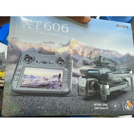
Out of Stock
Flying camera XT606 GPS Smart Drone – Advanced Aerial Photography & Smart Flight Drone
₦ 235,000
₦ 260,000
-10%


K911 MAX GPS Obstacle Avoidance Dual 4K HD Camera Drone
₦ 280,250
₦ 295,000
-5%


SG906MAX1 Drones With 4K Camera And GPS Long Range Drone Remote Control Profession
₦ 870,913
₦ 916,750
-5%


SG109 Max 2 WiFi 4K HD Professional Brushless 5G FPV GPS Dronen Camera Dual Lens Optical RC 3-Axis Gimbal Obstacle Avoidance Foldable With 2 Batteries
₦ 322,999
₦ 339,999
-5%


L900 MAX Drone 5G GPS Camera FPV Flight Time
₦ 599,850
₦ 700,000
-14%


Out of Stock
SG906MAX1 Drones With 4K Camera And GPS Long Range Drone Remote Control Profession
₦ 916,750
₦ 1,560,000
-41%

Professional F7s 4k Pro 5G Gps Obstacle Avoidance Dronè 3km Control Distance With Extra Batteries
₦ 2,280,960
₦ 2,500,000
-9%


S159 GPS Drone 8K Professional HD 4K Dual Camera Lens With 2 Big Batteries & Screen Remote 5G WIFI 500m -1km 360°Obstacle Avoidance Brushless Foldable Quadcopter
2.8 (4)
₦ 251,749
₦ 264,999
-5%


C-Fly Faith Mini AI Obstacle Avoidance Professional Wifi 5G Faith 2 Drone Camera 3km Ultra-HD 4K & 2 Batteries GPS Drone Latest Version
₦ 2,270,896
₦ 2,500,000
-9%


Out of Stock
S159 GPS Drone 8K Professional HD 4K Dual Camera Lens With 2 Big Batteries & Screen Remote 5G WIFI 500m -1km 360°Obstacle Avoidance Brushless Foldable Quadcopter
₦ 250,750
₦ 264,999
-5%


S155 MAX GPS Drone 4K Camera 5G WIFI FPV 360° Obstacle Avoidance Brushless Large Touch Screen Load capacity 500g RC Droné with extra battery
₦ 759,991
₦ 900,000
-16%


Professional F7s 4k Pro 5G Gps Obstacle Avoidance Drone 3km Control Distance With Extra Batteries
₦ 664,991
₦ 709,000
-6%


K19 Max GPS Drone Dual Camera 5G FPV Transmission Brushless Remote Control Aerial Photography Airdrop 4.5 inch Screen Display
₦ 549,999
₦ 850,000
-35%


Professional GPS Drone F7 4K HD Camera 5G WIFI 3-Axis Gimbal 3KM Optical Flow Vision System With 2 Batteries
₦ 559,550
₦ 589,000
-5%


F7s 4k Pro 5G Professional Gps Obstacle Avoidance Drone 3km Control Distance With Extra Batteries
₦ 617,491
₦ 980,000
-37%


L300 Max GPS Drone with Dual HD Cameras, FPV Live Video, with 2 batteries LCD Screen Remote Control Display, ZZSY Quadcopter1
₦ 275,499
₦ 289,999
-5%


KAI TWO Pro 2Km GPS Professional Drone 5G WiFi 4K HD Camera 3-Axis Gimbal Anti-Shake Photography Brushless Motor Foldable Obstacle Avoidance With 2 Batteries
₦ 299,249
₦ 314,999
-5%

Out of Stock
For Professionals 2025 New F7s 4k Pro 5G Gps Obstacle Avoidance Drone 3km Control Distance With Extra Batteries
₦ 4,800,000


K19 Max GPS Drone Dual Camera 5G FPV Transmission Brushless Remote Control Aerial Photography Airdrop 4.5 inch Screen Display
₦ 284,991
₦ 380,000
-25%


Smart Obstacle Avoidance Z103 GPS Professional 4k Screen Display Dróne with Dual Camera, Wi-Fi, FPV and Extra Battery
₦ 284,991
₦ 410,000
-31%
Frequently Asked Questions About mapping drone gps
How do I choose the right mapping drone gps category for my needs?
Match your mapping goals to core GPS mapping features such as waypoint planning accuracy, mapping screen control, camera resolution, and flight time.
What is the most complex attribute of mapping drone gps, and how does it impact results?
The most complex attribute is GPS-based mapping accuracy and waypoint routing, because it directly determines how precisely your maps reflect the real world.
Should a beginner or a pro choose different mapping drone gps setups?
Yes, beginners should favor automatic features like obstacle avoidance, intuitive mapping screen control, and longer battery life to build confidence.
How do I maintain and ensure compatibility for mapping drone gps gear?
p-Regular maintenance and firmware updates keep mapping drone gps accurate.
What extras should I consider to maximize mapping drone gps performance?
Look for bundles that include extra batteries and a mapping-screen remote to extend mapping sessions.