HomeHome & OfficeLarge Appliances & Home ImprovementMeasuring & Layout ToolsLinear MeasurementLaser Distance MetersZL-180 Handheld GPS Navigation Track Land Area Meter
₦ 208,000
2 units left
+ shipping from ₦ 950 to LEKKI-AJAH (SANGOTEDO)
0 out of 5
(No ratings available)Promotions
Delivery & Returns
Choose your location
Pickup Station
Delivery Fees ₦ 950
Ready for pickup between 27 February and 02 March if you place your order within the next 21hrs 52mins
Door Delivery
Delivery Fees ₦ 1,710
Ready for delivery between 27 February and 02 March if you place your order within the next 21hrs 52mins
Return Policy
Free return within 7 days for ALL eligible itemsDetails
Seller Information
Gadget Place
74%Seller Score
231 Followers
Seller Performance
Shipping speed: Good
Quality Score: Poor
Customer Rating: Excellent
Product details
Specification:
Model: ZL-180
Satellite accuracy: 0.8 m
Measurement error: 0.01
Length and width measurement: Yes
Manual fixed point measurement: Yes
Vehicle mode measurement: Yes
Automatic slope measurement: Yes
Real-time display graphics: Yes.
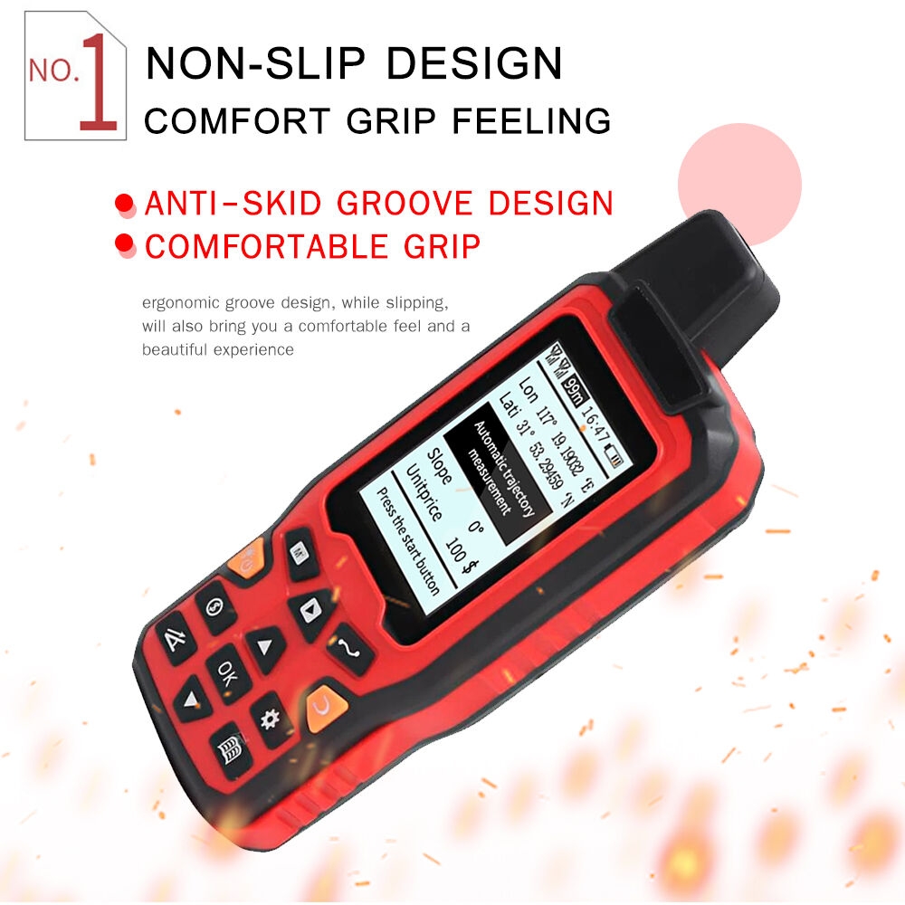
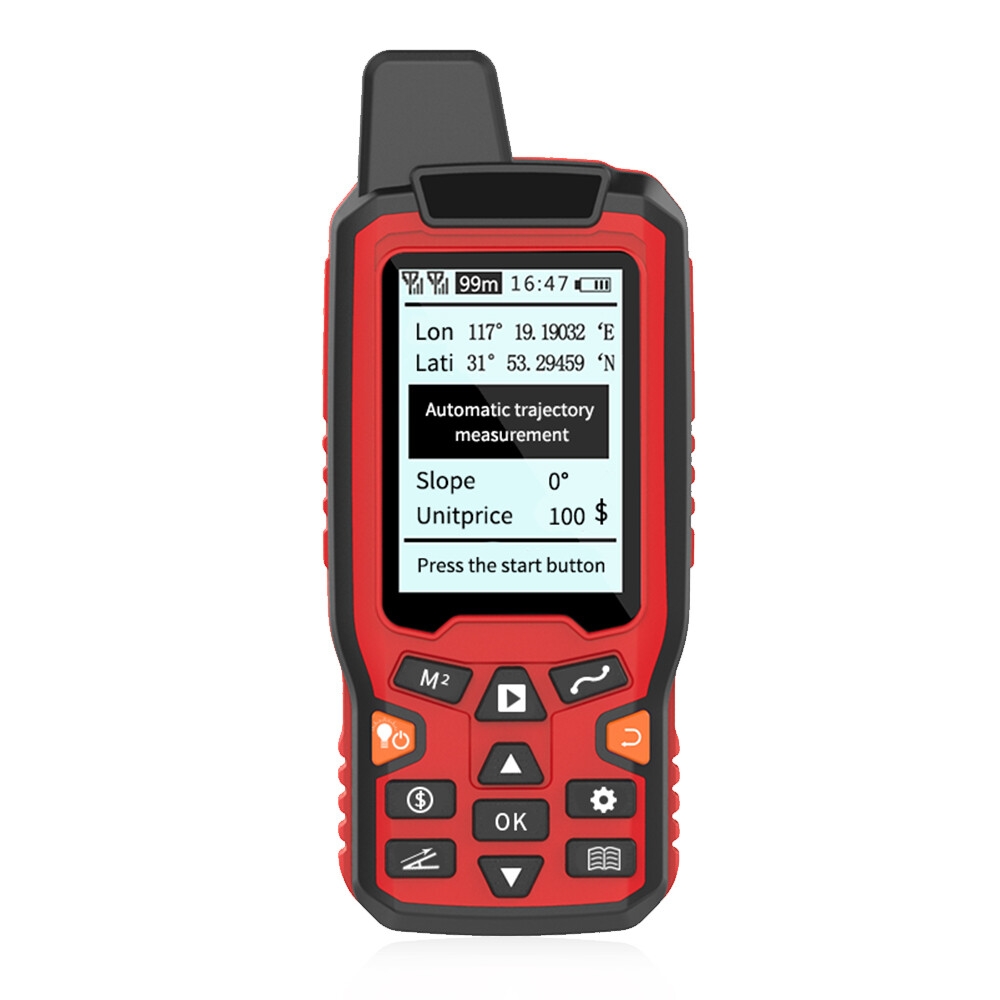
Three real-time display: real-time display trajectory, real-time display area, real-time display length.
Item Size: 140 * 58 * 22mm / 5.51 * 2.28 * 0.87in
Measurement mode:
1. Manual fixed-point measurement
2. Vehicle mode measurement
3. Measurement of length and width mode
Vehicle mode measurement
A. The harvester, rotary machine, seeding machine and so on are directly put on the car;
B. Set the working width (cutting width) of the fuselage, and the machine will automatically record the running track;
C. Walking length x fuselage length = operating area.
Manual fixed point measurement:
A. Enter the manual fixed-point mode and press the "start" button;
B. Press "start" button once at each inflection point to add a fixed point;
C. After returning to the starting point, press the "ok" key and the machine will display the measurement results.
Introduction to the ZL-180 Handheld GPS Navigation Track Land Area Meter
The ZL-180 Handheld GPS Navigation Track Land Area Meter is a cutting-edge device designed to provide accurate and reliable land surveying and navigation capabilities. Equipped with a 2.4-inch display, this handheld GPS device offers a user-friendly interface and a wide range of features to meet the needs of professionals and enthusiasts alike. Whether you are a land surveyor, outdoor enthusiast, or vehicle operator, the ZL-180 is designed to enhance your navigation and land measurement experience.
Key Features and Specifications
The ZL-180 Handheld GPS Navigation Track Land Area Meter is packed with features that make it a versatile and indispensable tool for various applications. Here are some of its key features and specifications:
- 2.4-inch display: The device features a clear and easy-to-read 2.4-inch display, ensuring that you can view important information and maps with ease.
- Land surveying capabilities: With its advanced GPS technology, the ZL-180 allows for precise land area measurement, making it an essential tool for professionals involved in land surveying and mapping.
- 100-240V power supply: The device is designed to be compatible with power sources ranging from 100V to 240V, ensuring flexibility and convenience in various settings.
- Slope vehicle mode: The ZL-180 is equipped with a slope vehicle mode, allowing for accurate navigation and measurement in challenging terrain and inclines.
- Manual fix mode: For enhanced control and precision, the device offers a manual fix mode, giving users the ability to fine-tune their navigation and surveying operations.
Applications and Use Cases
The ZL-180 Handheld GPS Navigation Track Land Area Meter is designed to cater to a wide range of applications and use cases, thanks to its robust features and capabilities. Here are some of the primary applications and use cases for this versatile device:
- Land surveying and mapping: The ZL-180 is an invaluable tool for professionals involved in land surveying, mapping, and related activities. Its accurate and reliable measurement capabilities streamline the surveying process and contribute to the generation of precise land maps and data.
- Outdoor navigation: Whether you are hiking, camping, or engaging in other outdoor activities, the ZL-180 provides reliable navigation assistance, allowing you to explore with confidence and safety.
- Vehicle operation: The device's slope vehicle mode makes it ideal for use in vehicles operating in varied terrain, such as agricultural machinery, construction equipment, and off-road vehicles.
- Geological and environmental research: Researchers and professionals involved in geological surveys, environmental studies, and related fields can benefit from the ZL-180's accurate measurement and navigation capabilities in remote and challenging environments.


Specifications
Key Features
- The harvester, rotary machine, seeding machine
- and so on are directly put on the car;
- Set the working width (cutting width) of the fuselage, and the
- machine will automatically record the running track;
- Walking length x fuselage length = operating area.
Specifications
- SKU: GE779IP6IOA7DNAFAMZ
- Product Line: Gadget Place
- Model: ZL-180
- Weight (kg): 1
- Color: RED
- Main Material: Plastic
Verified Customer Feedback

Customers who have bought this product have not yet posted comments
Related results
Flow metersLong distance security camera40m laser distance meterLong distance binocularsMeter rollerPlus meterGenerator meterSolar meteringReading glasses for long distanceDirectional microphone long distanceLong distance couple lampLong distance couple ringsLong distance listening deviceLong distance phone cardsLong distance touch giftsClamp meter accessoriesProfessional sound meterMoisture meter for flooringGenerator voltage meterFlow meter industrialPower meter adapterDistance pinkParking distance displayMeter and lancetsLong distance hunting binocularsLong distance safety braceletFar distance intercom with displayCordless intercom long distanceSex toys for long distanceLong distance toys for couplesClamp meter blueBlood meter blueAccurate moisture meter2 meter blue2 meter grey2 meter strip2 meter whiteGlucose meter blueHandheld meter yellowFrequency meter multimeterMeter spare partsWhite electric meterVolume meter for kidsWhite ph meterAdapter color metersMph meter for bicyclePvc meter socketPvc moisture meterPower meter for installers2 meter gold
/product/94/1631133/1.jpg?5690)
ZL-180 Handheld GPS Navigation Track Land Area Meter
₦ 208,000
Questions about this product?
/product/94/1631133/1.jpg?5690)
/product/94/1631133/2.jpg?5690)
/product/94/1631133/3.jpg?5690)